Final conference of the Project ''Establishment of GIS center in Zrenjanin''
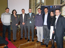
Yesterday the final conference of the Project "Establishment of GIS center in Zrenjanin" was held in Zrenjanin City Hall, with all the project participants present and many guests. The Project was implemented within Exchange 3 programme in City of Zrenjanin and partnership municipalities of Novi Bečej, Žitište and Nova Crnja.
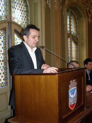
The conference was opened by Zrenjanin Mayor Deputy and Project Manager, Predrag Stankov, who pointed out that the establishment of GIS meant time and money savings for potential foreign investors, providing a faster, more qualitative and complete insight into the available land parcels, while, on the other hand, utility companies can increase efficiency, gain a better coordination and insight into infrastructure without lots of papers .


Miodrag Bogunović, the Head of ICT Department of the City Administration and Coordinator of the Project Work Group presented the activities implemented during the Project period as well as the most important results emphasising that the main objective was establishing of a reliable information system of the local self-government, to provide more efficient, economical and modern administration of the City resources.
On the behalf of Standing Conference of Cities and Municipalities (SKGO) and Exchange 3 team, Ivan Božović expressed his support to the City of Zrenjanin reminding that Exchange 3 programme was financed by EU, implemented by SKGO, and directed to improve the capacities and efficiency of local governments in Serbia .

Three examples were presented to give an idea and image of the essence of Geographic Information System and opportunities to use in practice, both for interested citizens and professionals in public companies, such as "Clean and Green" " City Heating Plant" and Zrenjanin industrial zones.
As stated by Dragan Radaković, the Head of Project and Information Technologies Department of the Regional Agency for Social Economic Development of Banat, new projects were to expect in GIS area as a further and continual development process.
Geographic Information System – GIS is a system for collecting, processing, analysis and presenting of space and other data regarding urbanism, spatial planning, construction land, utility infrastructure, environment and other aspects of living and working, which used to be kept in paper and digital form. The platform for future development of GIS has been accomplished by the establishing of the common information system at the level of local government Zrenjanin. GIS center is an integral part of the City Administration, of the Department of Information and Communication technologies and the Project included the Internet networking of GIS Center and 9 System members (3 partner municipalities, 5 local public companies and institutions in Zrenjanin).
This Project began on 18 September 2010 and finished on 17 March 2012. The signing of Intermunicipal Agreement on Cooperation in GIS Development Zrenjanin City and partner municipalities confirmed to be willing to work jointly on common interests and strengthening of mutual relations setting a good example of regional cooperation in Serbia .
The total Project value is 309,188.08 Euro, and EU funding is 264,.108.46 Euro, and partner municipalities 45,079.62 Euro.