Finished Project ''Establishing of GIS Center in Zrenjanin''
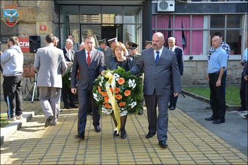
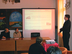
Yesterday in Novi Bečej the first, out of four planned, press conference was given regardign the finishing of the Project named "Establishing of GIS Center in Zrenjanin", implemented within Exchange 3 programme in the City of Zrenjanin and in the partnership municipalities of Novi Bečej, Žitište and Nova Crnja.
After the welcome word of the President of Novi Bečej Municipality Milivoj Vrebalov, the Project and its implementation were presented by Miodrag Bogunović, the Head of the ICT Department of the Zrenjanin City Administration and Coordinator of the Project Work group, Dragan Radaković, the Head of the Sector of Projects and Information Technology of the Regional Agency for Social-Economic Development Banat and Tomislav Ratković, Deputy President of Novi Bečej Municipality.


It was highlighted that GIS – Geographic Information System - is a system for collecting, processing, analysis and showing of space and other data referring to urbanism and space management, construction land, communal infrastructure, environment and other aspects of life of a city or a municipality, which all used to be kept in a paper and digital form. A platform for the future GIS development has been accomplished by establishing of common information system of the local self-government Zrenjanin. GIS Center is situated in the offices of Department of Information and Communication Technology , and the Project includes the Internet connecting to GIS system of 9 system members (3 partnership municipalities, 5 local public enterprises and one istitution in Zrenjanin).
In each municipality various pilot applications, chosen according to previous identifying of topics that may be acceptable for the local capacities. Novi Bečej Municipality developed the application for tourism development. The basic condition is to to have a data base of tourist facilities of Novi Bečej. According to the defined locations of tourist interest digital data were collected and then entered into the GIS data baze of tourism and then connected to WebGIS server. The application will be available on the Municipality web site and further developed.

The Project has been implemented in Zrenjanin, Novi Bečej, Žitište and Nova Crnja, with the City of Subotica as a participant, and it has been financed by the Delegation of the Euroepan Union in the Repbulic of Serbia, it was started on 18 Sep 2010 and it finishes on 17 March 2012. By the signing of the Intermunicipal Agreement on GIS development cooperation, the City of Zrenjanin and partnership municipalities confirm their willingness and common interest to keep and strenghten their networking setting a good example of regional cooperation to other cities and regions of Serbia.
The total Proejct value is 309,188.08 Euro, EU support is 264,108.46 Euro, and 45,079.62 Euro of partnership municipalities.
Similar press conferences are planned in Žitištu, 6 March, Nova Crnja, 7 March and the final conference in Zrenjanin, 14 March.